Under the topic of States of India, we previously discussed some quick facts on Kerala. In the present article, we shall discuss some qacts about a state which is the home for one of the world's wettest places. The state whose name is given to present geographical timescale - Meghalayan Age.
Meghalaya is bordered by Bangladesh to the West & South, and Assam to the North and East. Shillong, also known as Scotland Of East is the capital of the state. Districts of Garo, Khasi, and Jaintia of Assam were separated on 21 December 1972 to form the state of Meghalaya. Cherapunji and Mawsynram are the wettest places on earth located in Khasi Hills.
State Animal of Meghalaya is Clouded Leopard, State bird is Hill Myna.
Late Holocene epoch has been recently named after Meghalaya as Meghalayan Age.
History
Several Neolithic sites have been discovered in Garo and Khasi hills. The existence of the human settlements is traced back to the Neolithic ages. Some historians claim that the Meghalaya was the place where the first domestication of the rice happened. Khasi, Garo, and Jaintia hill tribes had their own local self-governed chiefdoms till they were all amalgamated into British empire.
Recently late Holocene epoch of geographic timescale has been named after Meghalaya as Meghalayan age. This is due to the study of recently discovered Krem mawmluh cave. Researchers found that Meghalaya was a coral island 3.5 billion years ago. Large tracts of mangroves were buried under the earth due to the continental movement of the Indian plate, which turned into coal beds. The corals turned into limestone caves. Fossils of shark and aquatic dinosaurs are found in these caves. Kermpuri (Fairy cave is the longest sandstone cave in the world with a length of 24.5 kilometers followed by Cueva Del Saman in Edo Zulia, Venezuela, a quartzite sandstone cave measuring 18.2km.
Geography
Meghalaya is a mountainous state largely covered with Archean rock formations. The region contains the deposits of limestone, uranium, and sillimanite (Al2SiO5 - Named after American scientist Benjamin Silliman). 70% of the area in the state is covered under forests. Garo, Kashi and Jaintia hill ranges cover the geography of the state.
Khasi hills are a part of Garo Khasi range. Cherapunji and Mawsynram are located in these hills.
Balpakram and Norkek national parks are located in Garo Hills. Siju Cave in Garo hills is the 3rd longest limestone cave in India.
Garo, Khasi, and Jaintia hills form the part of Patkai Bum range. Phawang Pui, also known as Blue Mountain is the highest mountain in Lushai Hills of Patkai Bum range in Mizoram.
National Parks
- Balphakram National Park
- Nokerk Ridge National Park (Biosphere Reserve)
Wildlife Sanctuaries
- Bhagmara Pitcher Plant Wildlife Sanctuary
- Nongkhyllem Wildlife Sanctuary
- Siju Wildlife Sanctuary
- Narpuh Wildlife Sanctuary
Some tourist attractions of Meghalaya
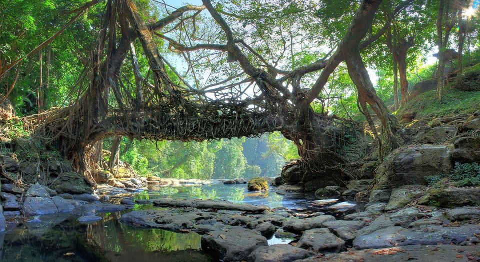
The natural heritage of the state creates many tourist attractions in the state. living root bridges across the small streams and sacred grooves are major attractions here. Some of the tourist spots are:
- Umaim Lake
- Cherrapunji
- Nohkalikai Falls
- Elephant Falls
- Shadthun Falls
- Weinia Falls
- Bishop Falls
- Hot springs of Jakram near Mawsynram
- Jarkem, Ranikor, Dwaki, Kahaid Dain Thlen Falls, Dienleng peak, Kyllang peak etc.,
- Nongkhnum Island is the biggest river island in Meghalaya and the second biggest river island in Asia, after the Majauli Island of Assam.
Sacred Grooves are large areas of forests dedicated to religious purposes and local beliefs. They are also homes for huge varieties of flora and fauna. Those areas are completly under the control of the local tribes.
Economy
The state is largely dependent on agriculture. About 80% of the population is involved in agricultural activities. Jhum Cultivation is widely practiced here. Many agricultural practices here are traditional and are highly unsustainable.
People and Polity
Meghalayan society is matrilinear, youngest daughter inherits all the wealth and takes care of the parents.
The state has a huge share of the tribal population. All three major tribes have their own political systems. Each clan has its own council known as Darbar Kur, which manages the internal matters of the clan. Village local assembly is called Darbar Shong. . All these local entitoes are collectively called as Raids, under the supreme politcal authority called Syiemship. Syiem ruled Khasi state through an elected state assembly known as Durbar Hima.
The state has a unicameral house with 60 Legislative assembly constituencies, two Lok Sabha constituencies, and one Rajya Sabha seat. Additionally Khasi, Garo and Jaintia hills have autonomous district admistrative councils each.
Some important festivals and visual arts of Meghalaya
- Shad Suk Mynsiem Dance
- Nongkrem Dance
- Behdeinkhlam Festival
- Laho Dance
- Chad Sukra
- Wangala Festival (Post-harvest festival)
- Ranikor Festival
- Meghalaya hosted the country’s first Strawberry Festival on Valentine’s Day
Geographical Indications of Meghalaya
Agriculture
Next topic - Karanataka (Coming Soon)
